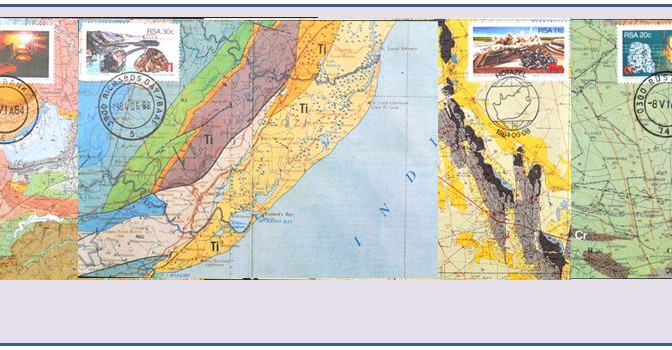
A Maximum Card (often referred to as a maxicard) is a philatelic postcard with a postage stamp placed on the picture side of the card. The stamp and card match or in some way relate to each other. Maxicards are officially released by many of the world’s postal services, but they are also generated personally by individuals combining a stamp issue with a simple souvenir postcard. In most cases, the cancellation is also related to the image on the front of the card and the stamp.
As a collector of minerals, mining and geology on stamps South Africa’s 1984 four-stamp set commemorating some of the country’s strategic resources was a fine add to my collection. It was not until a couple of years ago, however, that I learned that the officially released Maximum Cards S10-S13 for these stamps featured geologic maps. Not only would this satisfy another of my topical interests (maps on stamps), but as a retired geologist I found the inclusion of geologic maps on the “Maxicards” most interesting. Thanks to a tip provided by a fellow member of The CartoPhilatelic Society on the club’s shared discussion site, I was able to purchase a complete set via an online source.
Now it seemed only fitting that I research the stamps and maps a bit. This note will be constructed to accommodate both Philagems and The New CartoPhilatelist, newsletter of the Maps on Stamps Study Units, as the cards are equally collectible for members of both ATA study units.
